


Feybien Ramayanti, Jakarta – Greenpeace Indonesia suspects that the flash floods which have inundated South Kalimantan are because watershed areas lost around 304,225 hectares of forest cover between 2001 and 2019. Most of this has been converted into palm oil plantations.
Greenpeace Indonesia forest campaign spokesperson Arie Kompas explained that the watershed areas represent areas which should accommodate and absorb rainfall in South Kalimantan. But because the forest cover has declined drastically, the water carrying capacity has declined.
"Based on our observations, between 2001 and 2019 around 304,225 hectares of forest cover was lost there. This shows that the supporting capacity of forests in the region has declined drastically", said Kompas when contacted by CNN Indonesia on Monday January 18.
Kompas explained that South Kalimantan has two watershed areas (DAS) that accommodate and absorb rainfall and prevent flooding, namely the DAS Barito and DAS Maluka. Both are located in the Meratus mountains area.
But, he said, each year the rate of deforestation in these area has grown massively. This has been caused by palm oil concessions and open-pit mining which continue to plunder the forests.
"There below the foot of Meratus Mountain it's been pounded by palm oil [plantations]. On the other hand Banjarmasin [in East Kalimantan] is still affected by tidal waters. When there are high tides it worsens the floods", he said.
The massive rate of deforestation is an environmental problem which has been widely documented. Quoting from Forest Watch Indonesia (FWI) data in a report titled, Deforestation Rates an Alarm for Indonesia's Deteriorating Forests, the ratio of forest cover in Kalimantan by 2017 was only 47 percent of its total land area.
The rate of deforestation has continued to increase every year. In 2000 natural forest cover in Kalimantan stood at 33.2 million hectares. This declined to 28.3 million hectares in 2009, 26.8 million hectares in 2013 and 24.8 million hectares in 2017.
One of the factors causing the decline in forest cover is the huge number of concessions exploiting forest areas and land. FWI noted that by 2017 some 32 million hectares of natural forest was controlled by business concessions.
Kalimantan has the largest area – some 12.8 million hectares of forest – which has been released for business concessions. This figure is made up of 5.2 million hectares for production forest concessions (HPH), 756,000 hectares for industrial plantation forest concessions (HTI), 642,000 hectares for palm oil plantations and 1.5 million hectares for mining.
There are also some 4.6 million hectares of forest where there is an overlap between permits for HPH, HTI, palm oil plantations and mining. This data does not yet include areas controlled by the state-owned forestry company Perum Perhutani.
Impact on climate nationally
Aside from the decline in water carrying capacity, deforestation has also contributed to the climate crisis which has a big influence on extreme rainfall during the rainy season. With a combination of heavy rainfall and reduced water carrying capacity, the potential for flooding is growing.
And this is not just happening in Kalimantan. The impact is also being felt on a national scale because of the consistent decline in forest cover in various parts of the country.
In 2000, forests in Indonesia covered 106.4 million hectares. This declined to 93 million hectares in 2009, 88.5 million hectares in 2013 and 82.8 million hectares in 2017.
"The climate crisis is already upon us. This was the prediction by the IPCC (Inter-Governmental Panel on Climate Change) which projected what will happen 50 years in the future which is now before our eyes. Increasingly heavy rainfall, this is a fact of climate change", said Kompas.
Although there are many factors causing the climate crisis, such as use of fossil fuels and global warming, Kompas says that the felling of forests also releases carbon which worsens climate change.
The Environment and Forestry Ministry itself once revealed that floods are one of the impacts of the climate crisis which are not being handled well. This was revealed in a study titled, A Study on Climate Change in Indonesia, which was published in 2017.
"Climate change in the future could increase the regions prone to flooding, especially under a scenario of a period of repeated rain fall over 5-10 years and an increase in the frequency of large floods for repeated periods over 10-25 years", read the study.
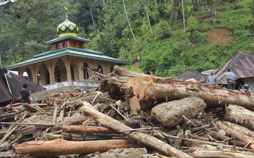
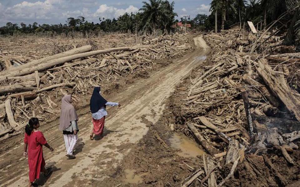
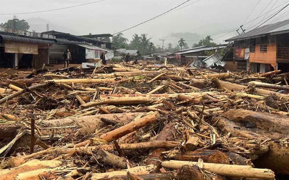
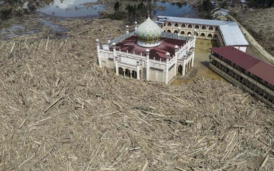
On Sunday January 17, 10 regencies and cities in South Kalimantan were affected by floods with a total of 112,709 people forced to seek shelter after 27,111 homes were inundated by floods.
According to provisional data gathered by the National Disaster Management Agency (BNPB), as many as 15 people have died as a result of the floods. Seven people died in Tanah regency, three in Hulu Sungai regency, one in Banjar Baru City, on in Tapin regency and three people in Banjar regency. (fey/bmw)
[Translated by James Balowski. The original title of the article was "Hutan Kalimantan Hilang, Banjir Menerjang".]